 Angel Doris
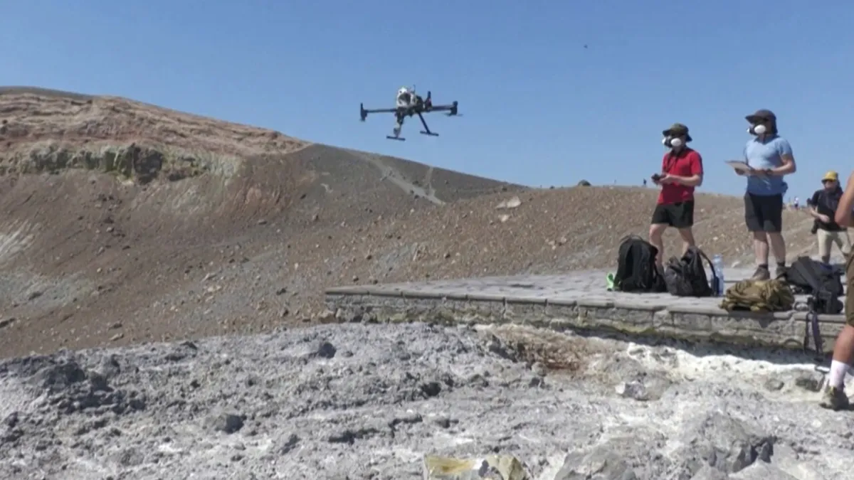
ITALY—A collaborative research project between leading German universities and the French National Centre for Scientific Research (CNRS) is now revolutionizing methods for monitoring volcanic activity. They are deploying cutting-edge drone technology to measure gas emissions from the active volcano on Vulcano Island, Sicily, with the primary goal of enhancing eruption prediction accuracy and minimizing natural disaster risks in 2026.
This innovative initiative utilizes unmanned aerial vehicles equipped with specialized sensors. These drones are capable of penetrating hazardous areas within volcano craters, collecting data on gas composition and emission fluxes that were previously difficult to access by conventional methods. This approach offers a comprehensive understanding of the internal magma conditions.
Predicting volcanic eruptions remains a complex scientific challenge. Precise real-time data from drones is key to understanding changes in volcanic dynamics, such as increased levels of sulfur dioxide or carbon dioxide, which often serve as early indicators before a volcano erupts.
The project is centered on Mount Vulcano, a stratovolcano in the Aeolian Islands, Italy. This island, which gave rise to the term “volcano,” serves as an ideal natural laboratory for researchers to test and refine their monitoring technology. Following its success on Vulcano, the team plans to expand operations to Mount Etna, one of the world’s most active volcanoes.
By 2026, drone technology advancements have reached their peak, enabling longer autonomous operations and more stable data collection under extreme conditions. Germany itself has become a leader in AI drone development. The integration of artificial intelligence (AI) also plays a crucial role in rapid data analysis and the identification of abnormal patterns.
“This approach is changing the paradigm of volcanic surveillance,” stated Professor Klaus Richter, one of the project coordinators from the University of Hamburg. “With drones, we not only obtain better data but also reduce risks for field researchers. This is a significant step forward in disaster mitigation.”
Higher prediction accuracy can provide longer evacuation times for communities in danger zones. This has the potential to save thousands of lives and reduce economic losses due to infrastructure damage. Local governments welcome this innovation as part of their disaster preparedness strategy.
Despite its promise, challenges remain, including drone battery life, extreme weather conditions around craters, and the integration of data from various sources. However, researchers are optimistic that with continuous development, this system will become a global standard for volcanic monitoring.
Model developed in Italy can be replicated worldwide, especially in the Pacific Ring of Fire, which has the highest concentration of active volcanoes. Adoption of similar technology in countries such as Indonesia or Japan would drastically increase their capacity to deal with volcanic threats. The utilization of drones for various purposes, including surveillance and security, has become a global trend.
This drone initiative by Germany and France in Italy not only demonstrates the power of international scientific collaboration but also serves as a beacon of hope. With this innovation, the future of volcanic disaster mitigation appears brighter, providing enhanced safety for communities living under the shadow of volcanoes.